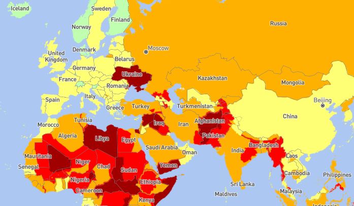
Pakistan – in particular Baluchistan is a region that is currently extremely high risk for travellers primarily due to kidnapping. Secondly, the border between Bangladesh and Myanmar is closed. Hiking the southern route would mean that I have to take a flight at least two times. The map below shows how dangerous travel is currently seen in different countries.
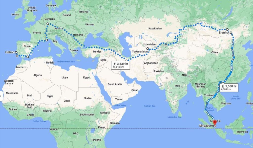
Therefore I would now prefer the northern route (Google 22’200 km, OpenStreetMap 24’200 km):
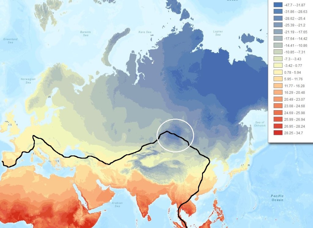
Central Asia faces a continental climate. Winter is extremely cold and tough for hiking, in particular in the North-East of the continent.
On the other hand, summer is unpleasently hot in the South:
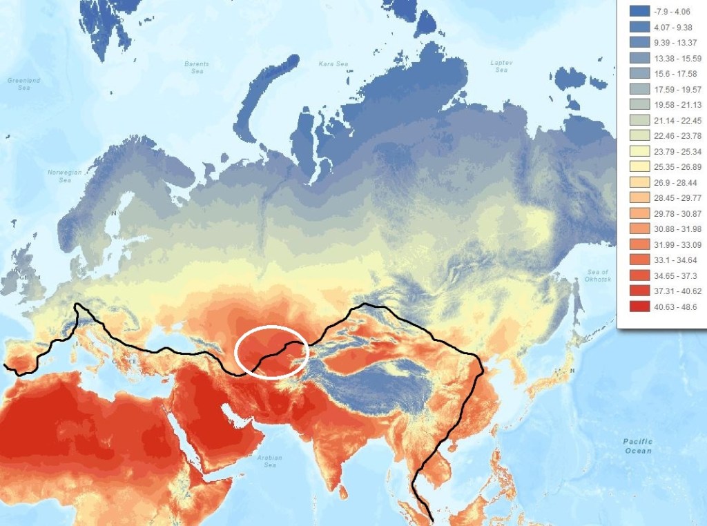
Therfore the Southern route (via India) should be walked only in Winter and the Northern route (via Central Asia and Mongolia) only in Summer. In contrast to Asia, the relatively low anual temperature amplitude in Central Europe allows hiking any time of the year.

I would be happy if you leave a comment